
A Neighborhood with Deep Roots
When people talk about Arvada West, they are usually describing a broad, welcoming part of the city rather than a neighborhood with one sharply defined historic boundary. The name is used for the western and northwestern portions of Arvada, including the communities around Simms Street, Ward Road, 64th Avenue, 72nd Avenue, and the neighborhoods near Arvada West High School. Local organizations identify dozens of smaller neighborhoods within the larger Arvada West area, reflecting how the community grew in stages over many decades. ([arvadawestcommunity.org](https://arvadawestcommunity.org/map.html?utm_source=openai))
Although the houses and shopping centers of Arvada West look distinctly suburban, the land beneath them has a much older story. Long before streets such as Simms, Quail, Kipling, and Wadsworth became familiar landmarks, the Ralston Creek and Clear Creek valleys were traveled and inhabited by Native peoples, including Cheyenne and Arapaho communities. The creeks provided water, wildlife, and natural travel routes through the landscape.
Arvada’s best-known early chapter began on June 22, 1850, when Lewis Ralston found gold while panning in a stream near the junction of present-day Ralston Creek and Clear Creek. His discovery helped draw prospectors west, although farming eventually proved more important to the community’s lasting prosperity. ([arvadaco.gov](https://www.arvadaco.gov/589/The-Founding-of-Our-Community?utm_source=openai))
How Arvada Got Its Name
The name *Arvada* dates to the community’s formal founding in the late nineteenth century. Benjamin Franklin Wadsworth purchased land in the Ralston Valley in 1863 and later worked to establish a town with a school and post office. When a town was platted on part of his land, his wife, Mary Ann, selected the name Arvada in honor of her brother-in-law, Hiram Arvada Haskins. The town’s founding notice was posted on December 1, 1870. ([arvadaco.gov](https://www.arvadaco.gov/589/The-Founding-of-Our-Community?utm_source=openai))
That name eventually traveled far beyond the original town center. As Arvada expanded westward, “Arvada West” became a natural way to describe the newer communities growing beyond Olde Town and the historic commercial core along Wadsworth Boulevard. The name was reinforced by the arrival of Arvada West High School, which opened in 1963 at 64th Avenue and Simms Street. The school was created as Arvada’s population increased and a second high school was needed west of the original Arvada High School. ([arvadawest.jeffcopublicschools.org](https://arvadawest.jeffcopublicschools.org/about?utm_source=openai))
From Farms to Subdivisions
For much of the nineteenth and early twentieth centuries, Arvada was a farming community. The fertile valley supported wheat, corn, oats, fruits, berries, melons, and vegetables. Celery became especially important, earning Arvada the nickname “celery capital of the world.” Farmers sent their produce to Denver and nearby mining camps, helping turn the small settlement into a productive agricultural center. ([arvadaco.gov](https://www.arvadaco.gov/589/The-Founding-of-Our-Community?utm_source=openai))
The arrival of the Colorado Central Railroad in 1870 connected Arvada more directly with Denver and Golden. Rail service made it easier to ship crops, receive supplies, and commute between communities. Later, improved roads and automobile ownership gradually changed the pattern of daily life. Roads such as Wadsworth Boulevard, 64th Avenue, and 72nd Avenue became important links between Arvada and the growing Denver metropolitan area. ([maps.arvada.org](https://maps.arvada.org/Attachments/HistoricProperty/SurveyReport.pdf?utm_source=openai))
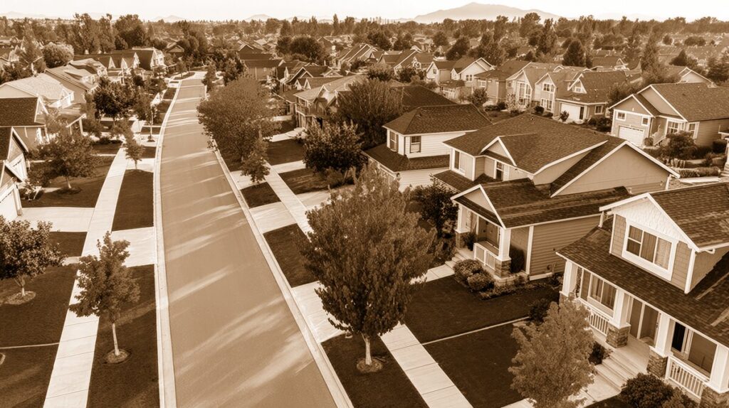
The most dramatic transformation came after World War II. Like many communities along Colorado’s Front Range, Arvada began changing from a primarily agricultural town into a suburban city. New families arrived, schools were built, and former fields were divided into residential subdivisions. In western Arvada, neighborhoods developed with curving streets, larger yards, neighborhood parks, and convenient access to major roads.
The setting around Arvada West High School became one of the area’s recognizable community anchors. Nearby schools, churches, small shopping centers, and recreation areas helped create the self-contained suburban rhythm that longtime residents still remember: children walking or biking to school, families gathering at parks, and neighbors meeting at local ball fields or community events.
Parks, Trails, and Everyday Landmarks
One of the great strengths of Arvada West is the way its modern neighborhoods remain connected to older natural features. Ralston Creek continues to shape the city, and the Ralston Creek Trail links parks, open spaces, and historic sites across Arvada. The trail’s eastern end begins near Gold Strike Park and the distinctive Spar Bridge, a 400-foot suspended cable bridge at the confluence of Ralston and Clear creeks. ([arvadaco.gov](https://www.arvadaco.gov/589/The-Founding-of-Our-Community?utm_source=openai))
Farther west, neighborhood parks provide a more intimate version of the same connection to place. Club Crest Park, Davis Lane Park, Alice Sweet Thomas Park, Meadow Lake Park, and Arvada Volunteer Firefighters Park are examples of the small green spaces that give western Arvada its family-oriented character. Many are woven into greenbelts and trail corridors, allowing residents to walk, ride bikes, play sports, or simply enjoy the broad Colorado sky.
Several of these names preserve earlier layers of local history. Davis Lane Park recalls Harpin Davis, an early settler who homesteaded land in the area and operated a ferry across Ralston Creek near today’s Simms Street. The old road known as Davis Lane eventually became Oak Street. Stories like this are easy to miss when driving through a modern subdivision, but they reveal how present-day streets and parks often follow routes first established by farmers and homesteaders. ([studylib.net](https://studylib.net/doc/7699476/arvada-parks-history—arvada-visitors-center?utm_source=openai))
Historic Places Beyond the Neighborhood
Arvada West’s history is best understood in relationship to Olde Town, the city’s historic heart. The downtown district preserves early homes, commercial buildings, churches, and civic structures that document Arvada’s growth from a farming settlement into an incorporated town. The town incorporated on August 24, 1904, when its boundaries were roughly Ralston Road, Carr Street, 54th Street, and Lamar Street. ([arvadaco.gov](https://www.arvadaco.gov/590/The-Town-Grows?utm_source=openai))
The McIlvoy House at 7307 Grandview Avenue, now home to the Arvada Historical Society, is another important place for understanding the city’s past. Historic districts such as Reno Park Addition and Stocke-Walter Addition also preserve early twentieth-century residential development near the original town center. ([arvadaco.gov](https://www.arvadaco.gov/425/Historic-Neighborhoods?utm_source=openai))
For residents of Arvada West, these sites are not distant museum pieces. They are part of the same community story. A drive east on 64th Avenue can take you from contemporary subdivisions and school campuses toward Olde Town’s older streets, showing in a few miles how Arvada grew outward while maintaining connections to its beginnings.
A Heritage That Keeps Evolving
Today, Arvada West is a blend of established neighborhoods, newer construction, schools, parks, trails, and busy commercial corridors. Some homes date from the postwar building boom, while others belong to later waves of development that reached farther west toward Indiana Street and the foothills. The area has also become more diverse in architecture, household types, and community life.
Yet the essential character remains familiar. Arvada West is still shaped by its relationship to open space, its neighborhood parks, its schools, and the creeks that guided the earliest settlement. It is a place where a modern family neighborhood can stand on land that once supported celery fields, where a park name can recall a nineteenth-century homesteader, and where the view west still connects residents to the Front Range.
That combination is what makes Arvada West special. Its heritage is not confined to one landmark or one historic block. It lives in the names of streets, the paths along Ralston Creek, the traditions of local schools, and the everyday memories shared by generations of residents. Arvada West continues to grow, but it has never entirely lost sight of where it began.